
Modern history: 1500-1700
The two centuries to 1700 were frequently punctuated by upheaval, war, and devastating violence. Historians refer to the bloodshed of the 17th century as ‘the General Crisis’, a period in which up to a third of the world’s population may have lost their lives. And yet these turbulent years saw the development of the modern economy. Familiar features such as market towns and pubs appeared for the first time, just as the world seemed to be tearing itself apart.
The Ulster Museum’s collection of items from the birth of the modern era bears testament to these trends. The conflicts of the era are reflected in the weapons and armour that we have on display. Coins, trading tokens, printed material and religious items trace the rapid development of civilian life in the shadow of war. Some of these items speak to intimate domesticity, such as Gaelic drinking vessels, called methers. These large cups are designed for social drinking—multiple handles make it easier to pass from one person to the next.
This period was transformative for Ireland. English and Scottish settlers were granted land in Ireland from the end of the sixteenth century. This process of settlement, known as the Plantation, occurred all over Ireland, but was particularly intense in Ulster.
The Plantation created conflict, but also prompted an interplay between different cultural traditions. The Dungiven Costume on display is evidence of this. The jacket is inspired by English fashion, while the tartan trousers have Scottish influences. The cloak, or mantle, is a distinctly Irish item. The implications of this cultural exchange had social, economic, and political implications for Ireland, even today.
The collection also includes gun money and other objects from the Williamite-Jacobite War in Ireland. We hold printed maps of Ulster, propaganda, paintings, and glassware dating to this period.
BELUM.P8.1978
A GENERAL MAP OF THE LANDS BELONG-/ING TO THE CITY OF LONDON AS THEY ARE / DIVIDED AND LET OUT TO THE 12 COMPA-/NIES,
BELUM.P13.1978
A GENERAL MAPP OF IRELAND
Map
BELUM.P351.1916
A MAPP / OF THE KINGDOME OF / IRELAND / BY RIC BLOME BY HIS MATYS COM.
Map
BELUM.P12.1978
A TRUE SURVEY OF / THE EARL OF DONEGALS = / BARRONIE OF ENISH = OWEN / CONTAINING THE TWO ADJACENT HARBOURS OF LOUGH =
BELUM.P3.1977
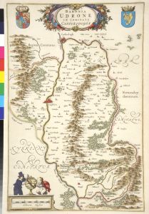
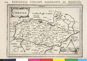
BARONIA / UDRONE / IN COMITATU / CATHERLOUGHAE
Map
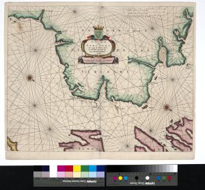
BELUM.P87.1977
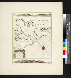
Carlingford Lough
MAP; Sea chart
BELUM.P86.1977
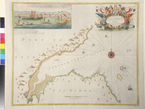
"Carreckfergus Lough"
MAP; Sea chart

BELUM.P74.1977
COMITATUS / LAGENIAE / THE COUNTIE OF / LEINSTER.
Map
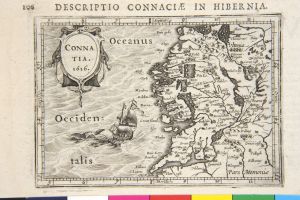
BELUM.P25.1978
CONNA / TIA. / 1616
Map
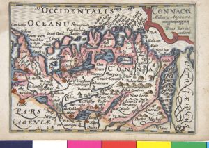
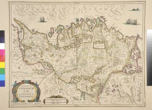
BELUM.P4.1978
CONNACK
Map
BELUM.P84.1977
DE NOORDOOST ZYDE / VAN / YERLANDT / VAN CAAP DE HOORN - HOUT / TOT HEDEHDE - HOUT OOCK HOE / 'TVAN SCHOTLANDT GESTREKT
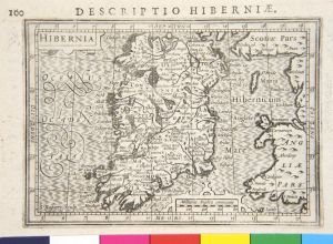
BELUM.P23.1978
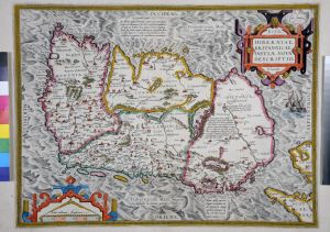
HIBERNIA
Map
BELUM.P72.1977
HIBERNIA / REGNUM / VULGO / IRELAND
Map
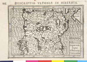
BELUM.P24.1978
HIBERNIA / SEPTENTR. / IN QUA / ULTONIA / CONNATIA
Map

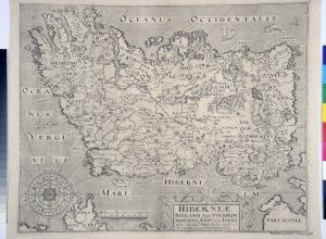
BELUM.P18.1978
HIBERNIA ANTIQVA / IERNA Orpheo & Aust. / IRISHDiodoro Siculo. / IUUERNA Iuuenali. / YUERDON Britanni. / IRELAND
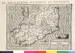
BELUM.P27.1978
HIBERNIA AUSTRAL. / IN QUA / MOMONIA LAGENIA
Map
BELUM.P640.1951
HIBERNIAE IRELAND ANGLIS YVERDON BRITANNIS ERIN INCOLIS. IERNA / ORPHEO and ARIST. IRIS DIODORO SICULO IVVERNA
BELUM.P230.1946
HIBERNIAE / BRITANNICAE / INSVLAE, NOVA / DESCRIPTIO. ERYN. IRLANDT.
Map
BELUM.P1.1976
HIBERNIAE / BRITANNICAE / INSVLAE, NOVA / DESCRIPTIO. ERYN. IRLANDT.
Map
BELUM.P939.1926
HIBERNIAE / IRELAND ANGLIS. YVERDON / BRITANNIS ERIN INCOLIS. / ERNA / ORPHEO & ARIST. IRIS DIODORO SICULO / IVVERNA
BELUM.P8.1976
IRLAN : / DIAE / REGN : / UM
Map
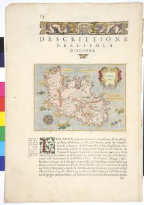
BELUM.P2.1979
IRLAND / DA
Map
BELUM.P7.1978
IRLANDA
Map
BELUM.P19.1977
IRLANDIAE / REGNUM
Map
BELUM.P28.1978
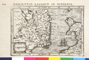
LAGENIA
Map
BELUM.P3.1978
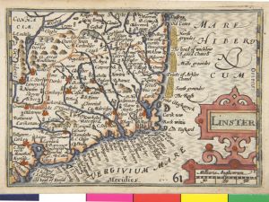
LINSTER
Map
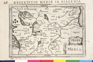
BELUM.P26.1978
MEDIA
Map
BELUM.P2.1978
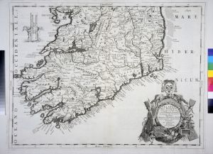
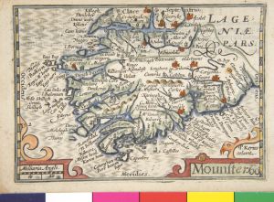
MOUNSTER
Map
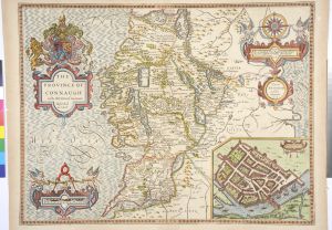
BELUM.P75.1977
PROVINCIA / CONNACH / TIAE / THE PROVINCE OF / CONNAUGT
Map
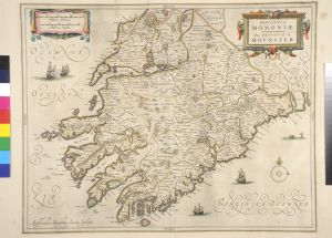
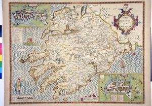
BELUM.P73.1977
PROVINCIA / MOMONIAE. / THE PROVINCE OF / MOUNSTER
Map
BELUM.P76.1977
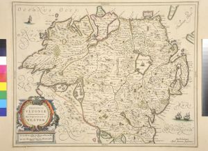
PROVINCIA / ULTONIAE / THE PROVINCE OF / ULSTER
Map
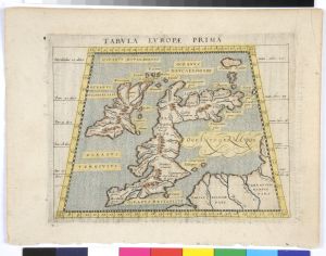
BELUM.P1.1979
TABVLA EVROPAE PRIMA
Map
BELUM.P67.1977
THE / COUNTIE / OF / LEINSTER / WITH / THE CITIE DUBLIN /DESCRIBED / BY I. SPEED
Map
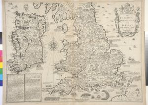
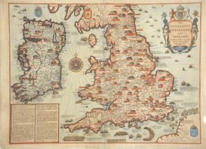
BELUM.P1262.1918
"THE / INVASIONS / OF ENGLAND / AND / IRELAND / WITH AL THEIR CIUILL / WARS SINCE THE / CONQUEST BY I. SPEED"
Map
BELUM.P6.1976
THE / INVASIONS / OF ENGLAND / AND / IRELAND / WITH AL THEIR CIVILL / WARS SINCE THE / CONQUEST / BY I. SPEED.
Map
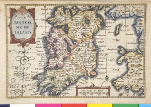
BELUM.P1.1978
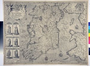
THE / KINGDO : / ME OF / IRELAND
Map
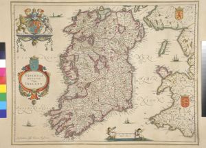
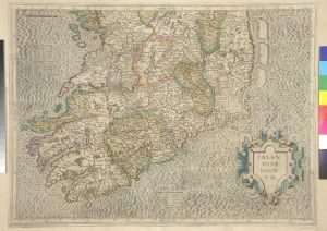
BELUM.P191.1912
THE / KINGDOM / OF / IRELAND / BY ROBT. MORDEN.
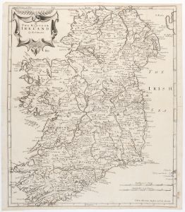
Map
BELUM.P65.1977
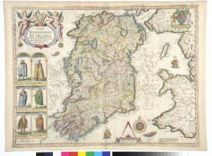
THE / KINGDOME / OF IRELAND / DEVIDED INTO SEVERALL PROVINCES, AND THE / AGAINE DEVIDED INTO COUNTIES / NEWLY
BELUM.P940.1926
THE / KINGDONE / OF IRELAND / DIVIDED INTO SEVERALL PROVINCES, AND THE / AGAINE DIVIDED INTO COUNTIES. / NEWLY
BELUM.P66.1977
THE / PROVINCE / OF / MOUNSTER / BY I. SPEED
Map
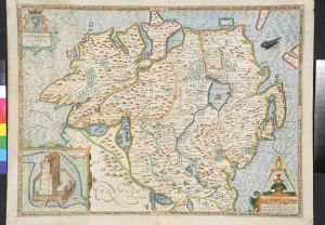
BELUM.P69.1977
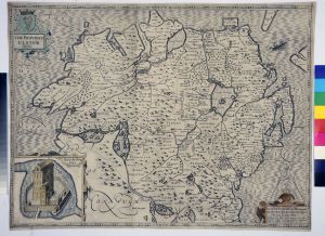
THE / PROVINCE / ULSTER / DESCRIBED
Map
BELUM.P68.1977
THE / PROVINCE OF / CONNAUGH (sic) / WITH THE CITIE GALWAYE / DESCRIBED / BY I. SPEED
Map
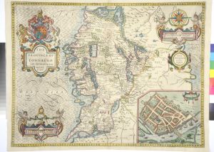
BELUM.P38.1977
THE / PROVINCE OF / CONNAUGH (sic) / WITH THE CITIE OF GALWAYE / DESCRIBED / BY I. SPEED.
Map
BELUM.P2.1976
THE PROVINCE / ULSTER / DESCRIBED
Map
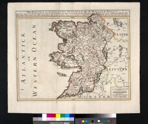
BELUM.P15.1978
THE PROVINCE OF CONNOUGHT
Map
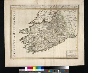
BELUM.P16.1978
THE PROVINCE OF MUNSTER
Map
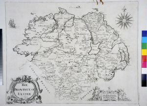
BELUM.P561.1951
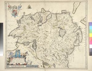
THE PROVINCE OF ULSTER
Map
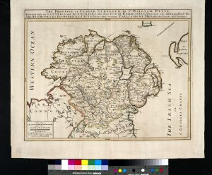
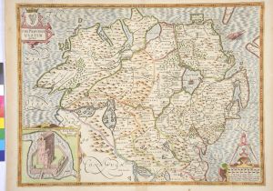
BELUM.P14.1978
THE PROVINCE OF ULSTER
Map
BELUM.P562.1951
THE PROVINCE ULSTER DESCRIBED.
Map
BELUM.P29.1978
UDRONE
Map
BELUM.P5.1978
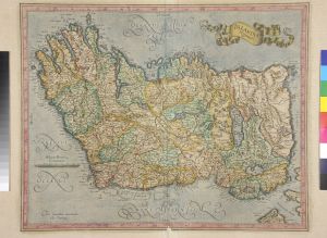
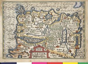
ULSTER
Map
BELUM.P10.1976
VLTONIA / HIBERNIS CUI - GUILLY : / ANGLIS VLSTER.
Map